The Leventhal Map and Education Center's forthcoming exhibition “More or Less in Common” will explore the geographic relationship between environmental management and historic patterns of injustice
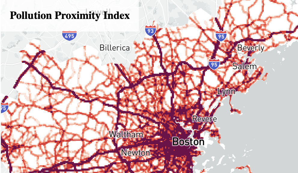
The advantages of a well-protected environment—and conversely, the hazards of a damaged one—have rarely been evenly spread. Instead, both historically and in the present day, access to a safe, healthy, and pleasant environment has been controlled not only by where you are, but also who you are. Public and private designs for green spaces, pollution controls, and remediation projects have been lavished on communities already at the center of power. Meanwhile, the places where the environment has been turned into a sacrifice zone are most likely to be the same places where poor families, immigrants, and people of color find themselves living and working.
What links these uneven environmental and social patterns together is geography. Sometimes they quite literally map onto one another. For this reason, maps can provide powerful tools for understanding—and challenging—these injustices.